Haleakala ascent via Kaupo Gap - Pat Rorie
 |
| Kaupo Gap from South Maui coast --Photo by mauiguidebook.com |
Many people have hiked/backpacked down the Kaupo Gap from Haleakala Crater. Few, I would wager, have hiked/backpacked into Haleakala Crater via Kaupo Gap. What follows is an account of the latter by members of the Hawaiian Trail and Mountain Club circa 1999.
Date: Thu, 15 Jul 1999 From: Patrick Rorie Subject: Haleakala Crater Via Kaupo Gap
A friend once told me "The weather is everything!". While I don't entirely agree with this statement, I do believe that excellent weather is the foundation for a wonderful day hike/backpack trip. It sets the table for a memorable visit to a special place. Such was the case on Independence Day weekend 1999 for seven members of the Hawaiian Trail and Mountain Club who ventured up Kaupo Gap into Haleakala Crater on the island of Maui.
Our group, consisting of Arnold Fujioka, Chris Atkinson, "Big" John Darrah (making his seventh ascent of Kaupo Gap), Herman and Myra Dombrowski, Steve Becker and myself, caught the Aloha Air early bird (5:15 a.m. flight) from Honolulu to Kahului, Maui, on Saturday morning, July 3rd. David Bloch of Off-Road Shorefishing Expeditions ($350 total for our party of seven, contact him at (808) 572-3470) picked us up and we departed the airport in his suburban at 6:20 a.m. Because Dave had already purchased fuel for our stoves, we proceeded directly to the town of Kaupo on Maui's south shore via Route 37. Along the way we enjoyed nice views of the West Maui Mountains, Kahoolawe, and the Big Island. Upon arriving in Kaupo, Dave continued mauka up a semi-paved road to the trailhead (elev. 1,000 ft) sparing us atleast a mile of boring road walking.
Following final preps and the obligatory "before" photo, our group began the adventure at 8:15 a.m. past a wooden sign which read "Paliku 5.5 miles", an incorrect figure as we would find out later. Perfect hiking conditions prevailed (an abundance of blue sky and sunshine with a gentle breeze from the east) and directly behind across the Pacific Ocean hidden partially by cumulous clouds was a stunning view of the Big Island featuring the Kohala Mountains below Mauna Kea, Mauna Loa and Hualalai. With almost 5,400 feet of elevation to gain in just under 7 miles, we ascended, steeply at times, almost immediately through tall grass and a forested area, dark brown wooden posts marking the route. Fifteen minutes into the climb while ascending steeply on a dirt/gravel road, I noticed a national park sign indicating that we had two more miles to travel before reaching the park boundary. Between the trees the nice view of the Big Island directly behind continued with entirely blue sky above. Further up, our group passed a catapillar bulldozer on the right, and the light breeze at our backs made for a sweaty ascent (we learned to appreciate the shady stretches). Pleasant vistas of the lower countryside between the coast and the trailhead were ours to enjoy, and Myra, Steve and I (bringing up the rear) noticed black fiberglass pipes near or stretching across the footpath and could hear water flowing through them. Despite the tough climb, it was a gorgeous day through beautiful territory (the different shades of green).
We made the transition from the forest to an open light green low grass region and, soon after, reached a broad relatively level campground (approx. elev. 2,275 ft) at 9:20 a.m. complete with two white bath tubs and a small corrugated shelter. A large ten foot tall water tank located above the area provided H2O for visitors and in order to obtain fluid one had to remove the cover and dip a container into it. John drank from the supply freely without chemical treatment and Chris told me privately that it smelled funny. Since we were only a little over an hour into the trek I still had plenty of liquid in my bottles and passed when offered an opportunity to fill up. Light green slopes existed above the region and I recognized white puffy cumulous clouds advancing upslope from the west in the distance toward Haleakala Peak. The seven of us enjoyed the spot for a time sunbathing and checking out the sights (Mauna Kea across the deep blue Pacific Ocean, the southern coast of Maui in the direction of Kahoolawe).
Suffering from a hangover brought on by the consumption of too many beers the night before, Herman proceeded no further and his wife Myra certainly would stay by his side. This gave John the excuse to remain as well, the campground being one of his favorite locations to relax. Steve also elected to call it a day.
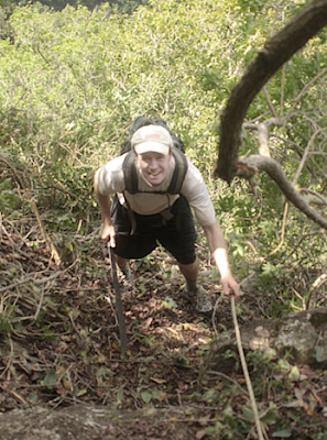
 |
| Photo by Joseph Bullough |
With so much time remaining in the day, Arnold, Chris and I decided to continue and departed our colleagues at 10 a.m. The steep climb resumed over a dirt/gravel road but the breeze intensified keeping the three of us from overheating. Occasionally, we stopped to catch our breath and, looking back, took pleasure from the sweeping views of the lowlands and southern coast. Later, while in transit, I recognized an abundance of pukiawe on the side of the now grassy road. Arnold and Chris tramped ahead of me as I halted to take notes and gaze at the surrounding topography. During the next stretch the angle of ascent increased and compared to hiking the steepest part of Wilhemina Rise (believe me, I should know, esp. since I carried a 45 pound backpack up Wilhemina three times back in April). Finally, the steep climb concluded, and I stopped again to catch my breath and stare at Kahoolawe and two prominent pu'us in the distance as well as the brown slopes below the massive ridge containing Pu'u Kumuiliahi and Haleakala Peak. Directly ahead, the crest of Kalapawili Ridge which forms the upper northern wall of Paliku came into view for the first time.
Pressing on, I ascended more gradually over a grassy road through open grassy terrain and a few healthy koa trees off to the right caught my attention. I delighted in the magnificent vistas of the southern coast toward Kahoolawe, and the four broad mountains of the Big Island really stood out. Like giant bookends, Haleakala Peak to the west and Pu'u Kuiki on the eastern side of the gap towered high above the crater floor. The sheer rocky cliffs forming the west wall of Kaupo Gap were in direct contrast to the steep vegetated flanks of the eastern pali.
Just prior to 11 a.m. I approached Arnold and Chris reclining under a grove of tall koa trees along the road and joined them as they took pleasure from the shade and sound of birds singing. After a fifteen minute break, we saddled up again and a short distance ahead passed a campsite on the left also containing a small corrugated shelter in route to the fenced Haleakala National Park boundary (approx. elev. 3,800 ft) which we reached at 11:24 a.m. The location featured a spectacular view of Haleakala Peak, now socked in by clouds, and the sheer rocky cliffs below the peak that form the steep west wall of the gap. The three of us entered Haleakala National Park via a gate in the fence, but I backtracked to take in the sights while Arnold and Chris proceeded toward Paliku. Beyond the gate upslope was a relatively level stretch through knee high grass under numerous tall koa trees offering ample shade. At 11:46 a.m. I passed a sign that read "Paliku 3.9 miles" and thought to myself "that was the longest 1.6 miles I've ever hiked!" in reference to the bogus mileage figure (5.5) on the trailhead sign. The steady ascent continued on a narrow but distinct footpath skirting the base of the steep east wall (no longer a road - the road terminating at the national park boundary), pukiawe on both sides.
Around noon I caught up with Arnold and Chris and sat down near them in shade under a stand of three spreading koa trees, the sunlight causing the koa leaves to glisten above our heads. We consumed lunch and took a nap (we caught the early bird, remember?), our solitude broken only by an occasional chopper flying high over Haleakala Peak.
Arnold, Chris and I found ourselves moving again over a well worn trail lit up nicely by the sunshine a few minutes prior to 1 p.m. The footpath became a graded contour and we gained elevation via switchbacks through a wealth of native flora growing on top of old lava fields. As I paused to take notes and gaze at the surrounding topography, Arnold and Chris moved ahead of me once more and I would not see them again until arriving at Paliku. Further ahead, a fifty foot vertical waterfall shoot located on the steep east wall grabbed my attention, and I spotted an ohia lehua with numerous red blossoms for the first time all day close to six additional lovely tall koa trees. Higher up, koa, the dominant tree thus far, disappeared, replaced by ohia lehua.
Clouds moved in from the north causing the sky to become overcast while I traveled through a lovely meadow filled with akala plants. Eventually, the sun came back out as I passed through another larger meadow where I obtained my first view of the crater floor toward Sliding Sands including the various cones. A narrow gully existed in the east wall to the right of the second meadow, and I was awstruck by the incredible amount of ohia lehua growing on the sides of the upper reaches of the gulch. I spotted a handful of native birds while passing through yet another meadow and rocky sheer cliffs bordered the right side of the field covered partially with grass and dotted with small ohia lehua.
Recognized Pu'u Kuiki (elev. 7,553 ft) towering high above the third meadow, bypassed a prominent pu'u (elev. 6,300 ft) on the left and enjoyed the wonderful final level approach to the Paliku Cabin, the completely clear surrounding ridges and peaks lit up nicely by the afternoon sun. Halted to study a wooden sign at a junction which read "Kaupo 8.0 miles, Kaupo Trailhead 6.8 miles".
Arrived at the Paliku campground and cabin (elev. 6,380 feet) shortly before 4:30 p.m. and proceeded to the place where Arnold and Chris had their tents set up. While the tract they chose was more discrete in case a ranger should come around checking for permits, it was too bumpy for my taste so I decided to take my chances in the open with a flat campsite.
At 6:20 p.m. I recognized the completely cloudless sky except for a few puffy clouds low on the horizon down Kaupo Gap and totally clear Haleakala Peak and Pu'u Maile visible to the west, the slopes of Pu'u Kuiki covered with ohia lehua. When the campground became engulfed in shadow we experienced a significant temperature drop causing campers to put on additional clothing. I ate dinner with Inger Lidman, Laura ?, Charlotte Yamane, Steve ?, and a friendly Japanese lady, and all of us took pleasure from excellent star gazing that night, the silhouette of the mountains with the stars in the background made Kaupo Gap very obvious.
At ten minutes before 10 p.m. the temperature outside my tent read 42.5 degrees fahrenheit and I retired for the evening at 10:05 p.m.
- For an account of a 2009 ascent of Kaupo Gap, here is Joseph Bullough


Aloha, great article!
ReplyDeleteThanks so much for using my photo. Could you kindly add a hyperlink to the article for the credit, it helps folks who may want to read more and also assists with my SEO.
For your convenience the URL to the article is: http://mauiguidebook.com/adventures/haleakala-backside-kipahulu-to-ulapapakua/
Mahalo!
-Mark
Try the hike from Olowalu store along the stream and over the peak to Waikapu.
ReplyDeleteThree days of glorious self-torture :)